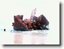
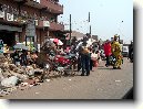
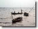
Město: Utonbaterentie, Region: Delta
Zpět na článek: Nigérie
|
Navigace mapy Celého Světa online: Kliknutím a tažením na mapě Celého světa, nebo použijte zoom kontrol.
Zeměpisná šířka: | 5,8000 (5°47'60.000"N) |
Zeměpisná délka: | 5,1167 (5°7'0.012"E) |
Nadmořská výška: | 1 m |
|
| |
|
|
|
|
GMT čas: +1 hodin | Posun oproti ČR: 0 hodin |
Vzdálenost města Utonbaterentie do 25 největších měst státu: Nigérie
|
Přímá vzdálenost | Km |
| Utonbaterentie - Lagos | 204 km |
| Utonbaterentie - Abia | 308 km |
| Utonbaterentie - Ogun | 230 km |
| Utonbaterentie - Kano | 784 km |
| Utonbaterentie - Ibadan | 222 km |
| Utonbaterentie - Kaduna | 584 km |
| Utonbaterentie - Port Harcourt | 237 km |
| Utonbaterentie - Benin | 82 km |
| Utonbaterentie - Maiduguri | 1 110 km |
| Utonbaterentie - Zaria | 651 km |
| Utonbaterentie - Aba | 260 km |
| Utonbaterentie - Jos | 619 km |
| Utonbaterentie - Ilorin | 307 km |
| Utonbaterentie - Oyo | 263 km |
| Utonbaterentie - Enuga | 271 km |
| Utonbaterentie - Enugu | 271 km |
| Utonbaterentie - Abeokuta | 246 km |
| Utonbaterentie - Sokoto | 807 km |
| Utonbaterentie - Onitsha | 189 km |
| Utonbaterentie - Onicha | 142 km |
| Utonbaterentie - Warri | 77 km |
| Utonbaterentie - Oshogbo | 227 km |
| Utonbaterentie - Okene | 230 km |
| Utonbaterentie - Calabar | 367 km |
| Utonbaterentie - Katsina | 846 km |
Vzdálenost města: Utonbaterentie do Top 10 měst světa
|
Přímá vzdálenost | Km |
| Utonbaterentie - Praha | 5 002 km |
| Utonbaterentie - Berlín | 5 251 km |
| Utonbaterentie - Londýn | 5 106 km |
| Utonbaterentie - Los Angeles | 12 610 km |
| Utonbaterentie - Moskva | 6 255 km |
| Utonbaterentie - New York | 8 674 km |
| Utonbaterentie - Paříž | 4 797 km |
| Utonbaterentie - Peking | 11 371 km |
| Utonbaterentie - Rio De Janeiro | 6 147 km |
| Utonbaterentie - Sydney | 15 337 km |
| Utonbaterentie - Tokio | 13 412 km |
Podpořte nás ·
Kontakt·
Kniha návštěv ·
RoboStav
Copyright (c) 2026 by CELÝSVĚT. Všechna práva vyhrazena!
Kontaktní e-mail: celysvet(zav)email.cz